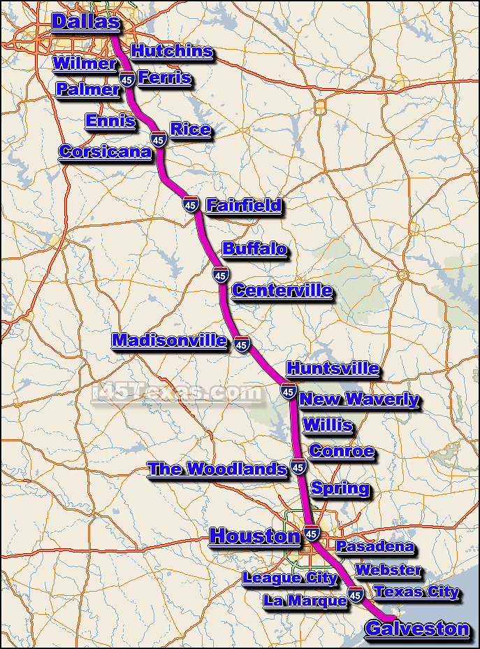
is
a major
traffic
corridor and interstate highway that travels generally in a north-south
direction across the eastern portion of Texas state.The
i-45 is the main interstate highway route between
Houston and
Dallas ... the
i-45 also connects a number of smaller cities located along it's route, including;
Conroe, Galveston, Huntsville,
League City, and The Woodlands,
to name a few.
The entire length of the I-45 is approx. 286 miles long, and requires a
continuous driving time of approx. 4 hrs. and 46 minutes to complete
- when averaging a speed of 60 miles per hour.
The distance between downtown Houston and Dallas along the
i-45 is approx. 239 miles, and requires a continuous driving time of
approx. 3 hrs. and 58 minutes to complete - when averaging a
speed of 60 miles per hour.
From it's north-end, i-45
travels travels south from
Dallas... towards it's south-end the i-45 reaches
Houston... then from the Houston
area, the i-45 continues
south
towards Galveston
Island... once in
Galveston, the i-45 terminates and becomes
"Avenue J" or "SR 87".
During hurricane season, the i-45 serves as a primary hurricane
evacuation route from the metro Houston and Galveston area's
during strong hurricane activity.
We currently provide real-time
traffic maps
for over a dozen cities located along the
i-45 corridor.